You are currently browsing the category archive for the ‘Transport’ category.
Spoiler alert: we made it!
Start: Destruction Bay, Yukon Territory, Canada
End: Anchorage, Alaska, USA
Miles: 542 mi
TOTAL TRIP STATS: 3,700 miles / 6 days / avg. ~ 610 miles a day, or 12 hours of driving
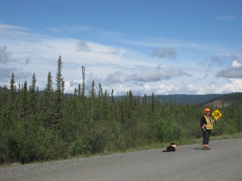
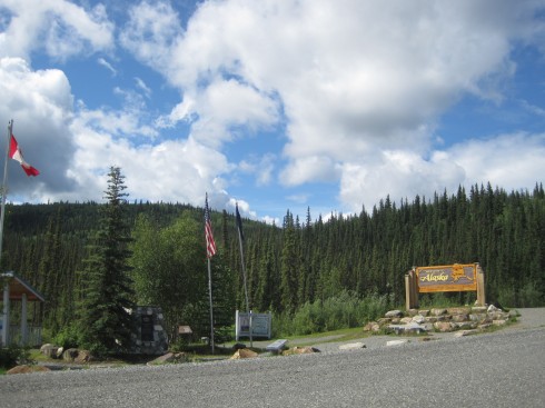
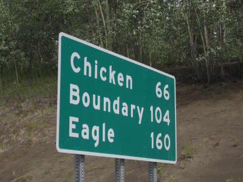
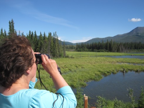
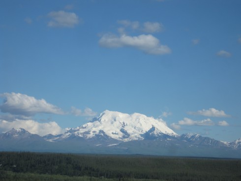
Highlights: Seeing a grizzly bear and two cubs on the road right before the U.S. border … we couldn’t stop because we were in a line of construction. Those things sure are big! Arriving back in the U.S. after five days! Cheap(er) gas prices, with no need for litre and dollar-amount conversion. Seeing not one but TWO brochures for Chicken, Alaska – and stopping to take a photo of the sign at the start of the highway up to it. Meeting a couple from Washington and seeing a moose through binoculars. Crazy wind and mountain views all along the highway to Anchorage. Driving through a winding mountain pass, with a road sort of tacked onto the side like it would fall off with a little shake. Stopping to observe a glacial stream (and learning a thing or two about property ownership in Alaska… turns out even on public roads, the land itself is owned to the centerline by the parcel owners…) Knowing this was finally, finally the last day of driving – and being able to make the push through. Returning to multi-lane highways between Palmer and Eagle River. Driving into civilization. Seeing the big “Anchorage Welcomes You” sign. Stopping. Sleeping. Not driving anymore.
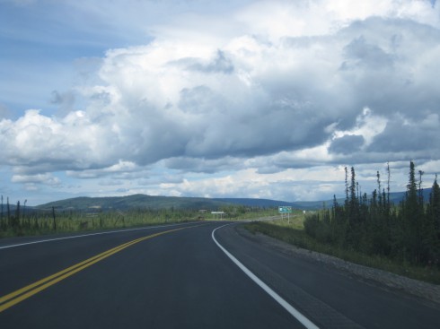
Lowlights: Road quality, although it actually wasn’t as bad as we had heard. The roads outside Whitehorse were almost worse, as (unlike most other times we’d driven) it had not been previously raining, so the dust kicked up in all its dusty glory. Getting to our motel room at 1 AM after unloading all my stuff and realizing there was no way we would get a good night’s sleep on my empty floor.
I haven’t gotten the Google map to work properly since I posted it on Day 2, but in the interim they seem to have updated the route to include that last bit of bad road between Whitehorse and Beaver Creek – before, Google directions would not even register that segment as a passable road! (And to be fair, some of it was pretty bad… full dust and gravel and major potholes). Here is a link to the overall route map, starting from the Chicago area (and not including the drive from Ithaca to Buffalo to Hilliard to Indiana). And here is the total route from Ithaca, about 4,500 miles.
Greetings readers,
My mom and I arrived safely in Anchorage around midnight (while the sun was still at twilight stage) last night! The last few days’ drive have been long but AMAZING, and I will be posting photos and summaries retrospectively in the next few days when I have Internet access hooked up.
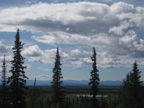
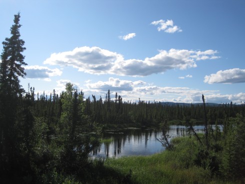
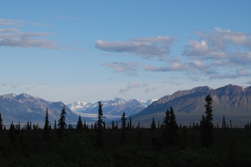
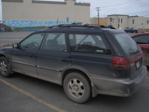
Summary: We drove through Alberta, British Columbia, and the Yukon Territory, saw 34 states and 9 provinces’ license plates, and saw the following animals (I have a count of totals elsewhere) – moose, wood bison, regular bison in a pasture, mule deer, arctic hare, coyote, grizzly bear (mama grizzly and two cubs!), black bear, ducks, swans, possibly a loon, a lot of ravens, and fifty billion mosquitoes (that is an accurate count). We drove through mountain passes, boreal forest, past beautiful lakes with mountains rising right from the shore, and past rivers and glaciers. We saw the tallest point in Canada (Mt. Logan) and went north of the 60th parallel. We saw the roadsign pointing to Chicken, Alaska (too far out of our way, but I am TOTALLY going back). And we took glamor shots of the Subaru in front of mountains, with the wheels covered in dust from the Alaska Highway. Good times, 3700 miles.
Starting work on Monday! Excited and overloaded at the same time!
Start: Regina, Saskatchewan, Canada (10AM)
End: (hopefully) Valleyview, Alberta, Canada (???)
Miles: ~ 700
No time for photos, we’re still on the road but might not end up with wi-fi. Will post more tonight if possible.
Highlights: West Edmonton Mall, the largest shopping center in North America! Huge. Haven’t seen bison yet, but did stop at the Royal Canadian Mounted Police training academy and heritage center, and I got a photo with my first moose (turns out it was a stuffed moose in a RCMP uniform). Entered Alberta this afternoon, looks about the same as SK but beautiful sunny skies and soon, SOON we will see some bison.
Lowlight: We spent too much time in Regina and will have a late night tonight. Oh well, there’s always tomorrow and more road to go.
Three more hours to go, and we’re stopping in Valleyview, AB for the night (or somewhere on the way, if we just can’t go any further). Tomorrow we head into British Columbia, and really begin the wilderness leg of the trip!!!
Start: International Falls, Minnesota (9AM)
End: Regina, Saskatchewan, Canada (10PM)
Miles: 626
Highlights: Beaver dams! Blue heron! Prairie dogs which had taken over an empty lot in Portage la Prairie! So much wildlife, and luckily the only animals we’ve hit (and boy have we hit them) are lots and lots of bugs. Canada is lovely in western Ontario and pretty uneventful otherwise, although the drive is just interesting enough to not get too monotonous. Stopped for lunch at Yesterdays Restaurant in Kenora, ON, looked like a small summer-tourism town among the woods and lakes. We’ve been keeping track of license plates and in addition to various U.S. states, we’ve seen Nova Scotia and New Brunswick! (The harder-to-find plates when you’re this far west). If we see Prince Edward Island we’ll automatically win.
Lowlight: Regina, at least the outer suburby area where our hotel is, has SO. MANY. MOSQUITOES. We got bitten up just getting things out of the car, ugh! One of the disadvantages of the prairie.
We have to get on the road so I’m only uploading one photo. Today we plan to get to and past Edmonton, and ideally to Grande Prairie or Valleyview in northwest Alberta. Apparently Kate and William (the royals) are also in Alberta these couple days… I’m guessing they were smart enough to fly to their destinations though!
And, the map – I realized the embed link didn’t work so just click on it and zoom in!
http://maps.google.com/maps/ms?msa=0&msid=201480590623565578563.0004a5df2b74730aa1961&ie=UTF8&ll=50.148495,-100.879585&spn=22.972677,66.785301&t=h&output=embed
View Alaska Trip in a larger map
Start: Highland, Indiana (9 AM)
End: International Falls, Minnesota (12 AM)
Miles: ~ 650
Monday: We set off from Nana’s house yesterday morning and drove north through Chicago, Madison, Eau Claire, rural Wisconsin, Duluth, and rural Minnesota until we stopped just shy of the border in International Falls.
Highlights: Wisconsin sure has a lot of cheese stores! We saw a Castle, Haus, Chalet, and several of unspecified type. Duluth is actually a pretty nice city! Really cool grain silos, large ships, and other industrial buildings along the port and bridge between Wisconsin and Minnesota. Saw a redwing blackbird, and after dark a few foxes and deer on the side of the road. The last leg of the trip was the roughest, in the Boundary Waters national area, which included hard rain and high winds, fireworks going off DURING said rain and winds, fog, deer looking ready to bolt, and most of all the dark woods. We were going to cross into Canada last night, but we saw the motel sign and just needed to sleep.
Lowlight: I think my camera lens is broken. AGAIN. All these photos are coming out grainy and just wrong. Will look into this…
Tuesday: Officially leaving the U.S. today, not to return until reaching the Alaska border. After crossing into Canada first thing this morning, we’ll be heading northwest to Winnipeg and Regina, stopping in the city or perhaps going a few more miles down the road.
Anchorage or bust!
Below is a map (hopefully this works!) that I’ll be adding to as we go along to track the route. Notice that according to Google, the area between Whitehorse YT and Tok AK doesn’t really exist.
http://maps.google.com/maps/ms?msa=0&msid=201480590623565578563.0004a5df2b74730aa1961&ie=UTF8&ll=51.524013,-116.50701&spn=22.972677,66.785301&t=h&output=embed
View Alaska Trip in a larger map
Mom and I are leaving for Alaska this morning, by way of Chicago, International Falls, MN and Winnipeg, Canada. I haven’t gotten my act together to set up a travel blog for our trip, but I’ll try to post some photos and updates here if we have wi-fi service.
I’m also planning to start a new blog – or a new series on this blog – about life in Alaska. I’ll be publicizing that once I get my Internet connection (i.e. connection to the rest of the world) set up and settle in at work.
Not feeling particularly ready for the trip, but here goes!
Along North Avenue, from Chicago’s west side well into the suburbs, at several major intersections lone men stand on the median strip of concrete – or just on the pavement between the two centermost lanes – holding a stack of newspapers. They start selling well before most people get in their cars to go to work, but remain there – in all weather – until late morning, when most commuters have already gone by. They sell the Tribune, the Sun-Times, and possibly the Daily Herald out past the numbered avenues of Melrose Park. Wearing mesh vests to stay more visible in the low morning light, they are an unusual sight on multi-lane arterial roads, standing in the middle of the street selling newspapers.
As a print subscriber to the New York Times, and previously the Tribune, I never had occasion to buy a paper, but always felt bad for the men on the median, especially on bitter cold Chicago mornings, or when piles of snow had turned to brown slush. Sure, it’s a job – but surely not a good one. I did see some people purchase papers while stopped by red lights, holding coins out through their cracked windows, and maybe they had a regular “newsman” at a particular corner. Even if I hadn’t a subscriber, though, I probably would not have bought one – after all, when would I read it?
The big arguments about why newspaper circulation is declining – a lot – are the usual suspects: the decline of reading and intellectual pursuit, the rise of the Internet and television news, general phasing out of newspapers as a respectable, reliable, and up-to-the-minute source of information. These are all surely important, though definitely debatable, particularly the “dumbing of America” argument. Nor is this a new phenomenon, according to the Washington Post:
“The decline [in circulation in 2005] continued a 20-year trend in the newspaper industry as people increasingly turn to other media such as the Internet and 24-hour cable news networks for information. Newspaper industry officials also blamed the National Do Not Call Registry, which has forced newspapers to rely less on telemarketing to secure subscribers, and a shift in strategy among major newspapers away from using short-term promotions to acquire new readers.” – Washington Post, 5-3-2005
Think about 20 years before 2005: 1985. No Internet, cable news just starting (if it existed at all, really?), and a culture on the verge of massive media change – MTV launched in 1981, a critical milestone in TV culture. If the decline in newspaper readership predates the Internet in its popular form by at least 10 years – and certainly more time than its current form – then maybe that’s not the main cause, or at least not the earliest cause.
Back to the newspaper sellers – they’re basically doing the same job that paperboys and others have done for decades, both on street corners in big cities and (in the case of home delivery) at suburban doorsteps. They are also doing the same work as the coin-operated paper boxes in downtowns and city neighborhoods, where people on their way to the bus, train, or office can stop and buy the morning news. The difference is, they’re delivering them to people in cars, not out on the sidewalk. Even those who drop off the paper on the porch in the morning, are mostly doing so for people who will end up driving to work. And the biggest population of adults who don’t go to work in the morning – the elderly – are also those who tend to still subscribe to the newspaper and read it regularly.
Is it too much of a stretch to speculate that maybe our large-scale shift in transportation behavior, i.e. commuting to work by car to perform primarily white-collar jobs, has heavily contributed to the decline of newspapers?
Sure, the Internet makes news easier to get, iPads and the like are seen as “killer devices” for paper media, and people watch more television than ever for information and entertainment. But if you think of reading a newspaper as an action requiring time, inclination, and the information source itself, commuting by car (having to drive) eliminates a big chunk of time when the newspaper might otherwise be read – in the morning, when you’re waking up and getting ready for the day, not fully functioning but wanting to find out what’s going on. Having to drive to work takes up most attention that transit users can give to other things like reading.
It is also significant that the phenomenon of “morning drive” talk shows, and other sources like NPR’s “morning edition,” get wide listenership no matter the actual quality of the show. You’ve got a captive audience in the car, probably two peak listening times at the beginning and end of the work day, and they want to get at least some idea of what’s going on in the world before they get to where they need to be.
There used to be evening newspapers, to get what happened at the end of the day, and some studies have shown that people tend to spend most time reading on their iPads and Kindles in the early evening. Perhaps they’ve simply displaced their reading time to be after work, but it also means they cannot read the newspaper (or any other device) on the way home either.
The biggest exception to the newspaper decline seems to be the New York Times, probably the most well-known and respected newspaper in the U.S. Coincidence that its primary readership, New York City and surrounding area, largely commutes by public transit if they work in the city? And similarly with D.C.’s Washington Post? And the Tribune and other papers publish variations on Chicago’s RedEye, a fluffy smaller-format paper that’s free and strategically placed in red boxes by train and bus stops. It’s just enough information to get you up to speed on big national and local news, and includes some fun things to do that week and a crossword. It’s free, quick to read, and as far as I can tell, popular with transit riders even if it’s mediocre quality. It serves the morning-newspaper need.
So, it would be really difficult to actually determine a causal link between the rise in commuting by car and the decline of newspaper readership, and certainly the Internet, TV, and “instant gratification” attitude toward information play no small part in this trend. But I think it’s worth considering how our land use and transportation decisions have affected other aspects of our lives, and what impact they have on our routines. The newspaper sellers of North Avenue are a half-hearted attempt to bring the newspaper into our cars, since we cannot get out and get them on the sidewalk. The problem is, we’ve eliminated the time in our day we used to have to actually sit down and read it.
Well, this is later than intended!
As usual in the perpetual-struggle-against-the-inevitability-of-time that is my life these days, I haven’t gotten ’round to posting things I should. On top of everything else, I’ll be spending several weekends here for a workshop…
… and thinking a lot about food:
The latter does not just refer to eating (though there’s been plenty of that). I’ve decided to focus my final project on local food systems, specifically examining methods of distribution (moving food from farm to consumer, with however many steps in between) and ways in which policy (planning!!) can help encourage movement “within the foodshed.” Ultimately the report will focus on implications for Chicago and its surrounding region, as the project will be written for CMAP (Chicago Metropolitan Agency for Planning), but will draw on literature and examples from other places.
To that end, I have a LOT to learn about this area, and need to keep the resources I gather in good order. In the coming weeks, I intend to post some of these resources online in a blog page, roughly sorted by geographic area and/or subject matter. The intent is not to create a full digital library (and license issues likely prevent me from posting actual documents anyway), but to offer an accessible collection of links about whatever I dig up on the subject that might be of interest. If possible, I will also post my finished report in Spring 2011.
I’ll try to keep the content reasonably updated, with the first steps being making the page and then pledging to update it (see above). In the meantime, much reading to be done!!
Cities, and people who think about cities, are usually all about place and space. I’d like to make the case instead that cities and the way we think about them – by which I mean, the everyday activities and movement within cities, more than the physical landscape itself – are really all about time.
First, time defines the urban in contrast to the rural. This is not to say that rural areas exist outside of time, but that they experience it differently. Time, in agricultural terms, is cyclical, relying on the predictable recurrence of sunrise and sunset, of spring and summer; action is dictated by the length of day and the growing season. Unpopulated rural areas, forests and wetlands, adhere even more closely to the natural cycle. Extraction operations like mining may rely less on that cycle, but only through the benefit of technologies like electricity and industrial machinery. In popular perception, at least, rural life is slow, unhurried, and “close to nature,” relying on the sun rather than the digital clock to tell the time; urban life, in contrast, is fast-paced, frenetic, and full of impatient crowds, rushing so as not to be late.
Suburbs seem to exist in the middle space between these two ideas – slower and calmer than a bustling downtown, but still tied to time-sensitive activities like the morning commute, the after-school program, and the evening news. Time is still measured, but much of it by the car’s dashboard clock.
It has been observed that we have built our cities with increments of time: the “forty-five minute rule” claims that city size has historically been determined by the length that can reasonably be travelled in forty-five minutes. If on foot, about two to three miles; if in a horse-drawn cart, somewhat longer; if by train or car or motorized bus, longer still. While this may not hold true in all cases, it seems to make sense: a person can only spend so much of their waking hours travelling, or else nothing would get done. City height and density may have been determined in part by construction technology and infrastructure limitations, but its breadth may be most practically determined using travel times, not physical distance.
The importance of time in urban movement – and it seems that urban life is all about moving from one place to another – is most evident in public transit. We often choose one mode over another based on travel times, even if it puts us a couple blocks out of the way; we may even spend more money on a cab just to save time. Using NextBus and similar tracking services, we determine our schedule by the number of minutes to arrival, not the length or even number of stops the bus or train has to travel. Our estimated travel time may make one place seem more accessible than the other, even if they are both exactly one mile away. We measure our reasonable walking radius by minutes as much as by miles; and even in easily-understood grid cities like (midtown) Manhattan or Chicago, we orient ourselves at least as much to the time spent in transit than to the miles we travel every day. In more chaotic cities like Boston or Paris, the zig-zag distances we travel are hard to measure, and it’s not really worth doing so anyway.
A good rule of thumb: most places in Chicago seem to take forty-five minutes to reach; most places in Columbus take ten to twenty. If the destinations are close, we may take a leisurely walk and allow ourselves extra “cushion” time to leave. If they are further away, driving time must include a traffic jam and some time to search for parking; if taking public transit, we build in extra time to wait for the bus or train, and even more if a transfer is required. Unless it’s just up the street, we expect to take some extra time getting there.
Trains are most closely linked to time, and are often disconnected from space. Consider the origin of standard time itself: the development of cross-country train networks in the United States created the need for a common understanding of when noon or eight or five actually occurred, rather than each town measuring for itself by solar position alone. (A plaque near the Chicago Board of Trade building commemorates that city’s part in the “invention” of time.) Because the train’s route and schedule are already circumscribed, we think little of the actual distance we travel, but conceive of the trip more or less as a straight line from A to B, within a given time frame.
Train schedules and maps exist even further out of real, physical space: the stylized, rectilinear diagram of the London or New York subways alter the form of the city itself to be more legible as a network of colorful lines; stations that appear relatively far apart may indeed be only a block or two away, as is the case with the Regent’s Park and Great Portland Street Tube stations in London. [walking] [by train].
Furthermore, particularly for commuter rail with few or no connecting stations, the schedule is all we really need. When will it depart? When will I arrive? The intermediate locations, not to mention the actual path of the track, is irrelevant.
Inter-city travel may be more or less time-dependent than intra-city. While we pay attention to miles on the highway, relying on the odometer and the gas tank to remind us when to stop, when we travel by air, we worry primarily about whether or not we’ll miss our flight. The actual experience of travel is disconnected from the physical distance: we arrive in one airport, wait a bit, board the plane, perhaps watch landing and takeoff and catch glimpses of farm fields before ascending above the clouds, then touch down again at an eerily similar airport elsewhere. Frequent flyer miles remain somewhat arbitrary numbers, points we accumulate over time.
Because movement is such an integral part of urban life, we must inevitably rely on time to determine the rest of our actions. We generally work for a given number of hours, whether or not we are salaried; we take our children to and from school; we must pay attention to opening and closing times of our stores and restaurants and offices; we make appointments and plans and attend events according to the time we have left. And, of course, somewhere in the midst of everything we find time to sleep. We find time, lost time, make time, waste time, need more time or time off. A city itself may be a place, a location, a location in physical space, but in our everyday conception of the city in which we live, it is really a series of time.

