You are currently browsing the category archive for the ‘Nature’ category.
Well, I’ve been so focused on one aspect of my digital creative life (sorting a backlog of photos since last March, taking new photos) that I’ve somewhat neglected this one. But I want to post just a few recent highlights from Alaska:

Flattop Trail, Anchorage

Girdwood in July

Soldotna Fishing Pier

Homer, Beach

Park Strip, Anchorage

Mountains, Wasilla

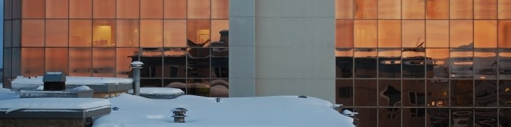
January Sunset, Downtown
I’ll get back to writing soon, and finally finish up those draft posts hanging out!
It’s actually dark at night, the leaves are browning and yellowing on the trees, and the snow marches down the mountains toward the city. Must be autumn.
September was a silent month on the blog but a busy month in real life – and October, though busy and starting stressful, will not be similarly silent. Which is to say, I’ll post soon.
And November is conference month! I’ll be in Fairbanks for the APA Alaska Chapter festivities, and heading to Baltimore to throw down some wholesale produce distribution knowledge with the Society of American City and Regional Planning Historians (SACRPH). And in the meantime, frantically tying together the loose ends in my life to make way for some new threads.

Last Warm Days on the Coastal Trail

- Autumn Along the Seward Highway

Better bottle this early morning sunlight soon...

Spoiler alert: we made it!
Start: Destruction Bay, Yukon Territory, Canada
End: Anchorage, Alaska, USA
Miles: 542 mi
TOTAL TRIP STATS: 3,700 miles / 6 days / avg. ~ 610 miles a day, or 12 hours of driving
Highlights: Seeing a grizzly bear and two cubs on the road right before the U.S. border … we couldn’t stop because we were in a line of construction. Those things sure are big! Arriving back in the U.S. after five days! Cheap(er) gas prices, with no need for litre and dollar-amount conversion. Seeing not one but TWO brochures for Chicken, Alaska – and stopping to take a photo of the sign at the start of the highway up to it. Meeting a couple from Washington and seeing a moose through binoculars. Crazy wind and mountain views all along the highway to Anchorage. Driving through a winding mountain pass, with a road sort of tacked onto the side like it would fall off with a little shake. Stopping to observe a glacial stream (and learning a thing or two about property ownership in Alaska… turns out even on public roads, the land itself is owned to the centerline by the parcel owners…) Knowing this was finally, finally the last day of driving – and being able to make the push through. Returning to multi-lane highways between Palmer and Eagle River. Driving into civilization. Seeing the big “Anchorage Welcomes You” sign. Stopping. Sleeping. Not driving anymore.
Lowlights: Road quality, although it actually wasn’t as bad as we had heard. The roads outside Whitehorse were almost worse, as (unlike most other times we’d driven) it had not been previously raining, so the dust kicked up in all its dusty glory. Getting to our motel room at 1 AM after unloading all my stuff and realizing there was no way we would get a good night’s sleep on my empty floor.
I haven’t gotten the Google map to work properly since I posted it on Day 2, but in the interim they seem to have updated the route to include that last bit of bad road between Whitehorse and Beaver Creek – before, Google directions would not even register that segment as a passable road! (And to be fair, some of it was pretty bad… full dust and gravel and major potholes). Here is a link to the overall route map, starting from the Chicago area (and not including the drive from Ithaca to Buffalo to Hilliard to Indiana). And here is the total route from Ithaca, about 4,500 miles.

Construction dog outside Beaver Creek - it has a jacket!!!
")
Welcome to Alaska (I should have gotten a better photo!)

Finally, the Alaska portion of the Alaska Highway
")
Boreal forest and mountains (Wrangell-Elias??)

Chicken, Boundary, and Eagle

Mom observing the moose

Pond along the Highway

Serious mountain situation

There's a glacier in there somewhere

Brought some of the Alaska Highway with us. Car needs a wash!
Start: Muncho Lake, British Columbia, Canada (10AM)
End: Destruction Bay, Yukon Territory, Canada (11PM)
Miles: 602
Our best (most efficient) driving day, I think. We didn’t do as many miles, but that was due more to the road than us. Part of what this day feel great was that we were actually on the Alaska Highway by mid-afternoon – felt so much closer to our goal, and really started to realize how far we had already come. The trip felt a lot more manageable being two days, not six. And when we reached our stopping point for the night, we knew that the next night would be in my apartment in Anchorage! (but actually ended up being a motel because it was so late and I had no furniture or anything there).
Highlights: Seeing a herd of 80-100 wood bison on the ride of the road. Driving into the Yukon Territory and realizing we’d pay less for gas, and as it turns out would actually have roadside bathrooms (BC doesn’t). Watson Lake, where we were practically overrun by RVs but saw two Northwest Territory license plates, as well as the Sign Post Forest (it’s worth a look – none of the sites I found about it, including the one above, give sufficient indication of how freaking big this thing is). Stopping in Whitehorse, the capital of the Yukon, with not one but TWO McDonalds. Mount Logan (or was it Mount Hubbard?) in the distance. Kluane Lake and its accompanying park – really, really amazing. Looked like another world. Taking a “glamor shot” of the Subaru (covered in highway dust) in front of the mountains and the lake. The Talbot Arm Motel, where we stopped for the night, with its logo of a grizzled old gold miner or something. Splitting a bottle of wine to celebrate (early) our trip – “house” wine, Sawmill Creek, from Ontario.
Lowlight: As always, we put in a lot of hours that day, and didn’t get to stop as often as we might have. Being in the car for 12 hours a day was also really beginning to wear on me, and probably Mom as well, as if my legs were just stitching themselves to the seats. We tried to make semi-frequent stops on the side of the road to walk around, to look at the amazing scenery, and because there was really no one on the road, so it would be easy to just stop on the side of the road anyway. More mosquitoes, though still not as bad as in Regina.
We had one more (extremely long) day of driving left, but we’re almost there!
, BC")
Wood bison (including many babies!), BC

Yukon Territory welcome sign, Yukon (also note major discrepancy in translation)

Sign Post Forest, Watson Lake, Yukon

Walking through Sign Post Forest, Watson Lake, Yukon

Northwest Territory plate, Watson Lake, Yukon

Alaska Highway, Yukon
 of the Al-Can Highway")
Mom at Mile 1000 (1610 km) of the Al-Can Highway
 of the Al-Can Highway")

- Coyote at rest stop, Yukon


Kluane Lake National Park, Yukon

Kluane Lake National Park, Yukon

Subaru Glamor Shot, Kluane Lake National Park, Yukon
PS – if you can to go to Kluane Lake, do it. I would go back.
The next few posts (Days 4-6, and anything about Seward or Flattop) will be more retrospective, as they happened a couple weeks ago now. I’m catching up to the end of the trip, then will be more “forward” thinking after that!
Start: Whitecourt, Alberta, Canada (9AM)
End: Muncho Lake, British Columbia, Canada (11PM)
Miles: 692
On Day 3 we stopped about 50 miles short of where we should have, in Whitecourt, a small town basically made of motels. The Alaska Highway motel was not as desirable as I had hoped (that’s what I get for picking based on name alone) but we got on our way and saw what began to be the really awesome part of the drive. Also of note: it was still (twi)light around 10:30PM when we stopped at the motel, despite some clouds. We were clearly pretty far north, and it didn’t really hit us until then.
This might have been my favorite day of the drive, overall – mostly for the evening ride from Fort Nelson to our ending point, the Northern Rockies Lodge along breathtaking Muncho Lake, a long and skinny blue lake stuck among some really tall mountains. I wish I had gotten a photo of it at night (again, not fully dark out) but the morning ones will have to do. Also, the Northern Rockies Lodge was basically like staying in that hotel in Twin Peaks – it was a big log cabin, with each of the rooms having log walls (if on exterior walls) and a huge great room/morning dining area with windows overlooking the lake. NRL is owned by a (Swiss?) couple, and the husband is a bushpilot (flies those small sea planes etc) who will fly guests to lodges and remote places for day tours. If I had the time and inclination, I would most definitely go back there – driving in and out of it was great.
Highlights: Leaving Alberta finally, although we did get to see some more lovely prairies, the start of the northern woods with its short-ish dense evergreens. Awesome little rest stop with birches and bear-proof trash containers. Entering British Columbia and, shortly after, passing through Dawson Creek – MILE ZERO OF THE ALASKA HIGHWAY sign. Going past a place called Wonowon. The Fort Nelson hotel and its Tiki lounge/ballroom area. The drive between Fort Nelson and Muncho Lake. Really feeling like we’re in the far north. SEEING MOOSE!!! AND BLACK BEARS!!! And one sheep. Plugging my phone charger into a log (with an electrical outlet). Muncho Lake, which has a stupid name but is just beautiful.
Lowlights: Not listening to the Garmin (that somehow knew about a road closure that had just happened that week) and driving west anyway, only to hit an abrupt “Road Closed” sign with a mound of dirt that redirected us onto a gravel farm road and back the way we came. Apparently, some washouts/flooding nearby. Hitting a miles-long backup of construction around Taylor/Fort St. John where there was single-lane traffic to get across the end of a mountain pass and major bridge – no detours here, folks. Paying about $6/gallon ($1.40/litre) because of BC towns’ remote location and high taxes. Also, worrying about where to get gas and where we were going to stop – luckily, a woman at the front desk of the Fort Nelson Hotel was kind enough to call ahead to what ended up being a super awesome place to stay (see above).
The next day we headed into the Yukon, officially, and ended up with a similarly spectacular (but very different looking) lakeside view on Day 5. More to come. For now, some photos.

Nice Rest Stop, Alberta, Canada

Black Bear, Alberta, Canada

Mountains, 8PM, British Columbia?
")
Moose in the Mist, British Columbia, 10PM (wish it wasn't so blurry!)

Mist and Trees and Mountains, 10PM, British Columbia
, Muncho Lake, British Columbia")
Northern Rockies Lodge (seaplane dock), Muncho Lake, British Columbia

Upstairs hall, Northern Rockies Lodge
Start: Highland, Indiana (9 AM)
End: International Falls, Minnesota (12 AM)
Miles: ~ 650
Monday: We set off from Nana’s house yesterday morning and drove north through Chicago, Madison, Eau Claire, rural Wisconsin, Duluth, and rural Minnesota until we stopped just shy of the border in International Falls.
Highlights: Wisconsin sure has a lot of cheese stores! We saw a Castle, Haus, Chalet, and several of unspecified type. Duluth is actually a pretty nice city! Really cool grain silos, large ships, and other industrial buildings along the port and bridge between Wisconsin and Minnesota. Saw a redwing blackbird, and after dark a few foxes and deer on the side of the road. The last leg of the trip was the roughest, in the Boundary Waters national area, which included hard rain and high winds, fireworks going off DURING said rain and winds, fog, deer looking ready to bolt, and most of all the dark woods. We were going to cross into Canada last night, but we saw the motel sign and just needed to sleep.

Wisconsin

Bluffs, Wisconsin

Minnesota Welcomes Us
Lowlight: I think my camera lens is broken. AGAIN. All these photos are coming out grainy and just wrong. Will look into this…
Tuesday: Officially leaving the U.S. today, not to return until reaching the Alaska border. After crossing into Canada first thing this morning, we’ll be heading northwest to Winnipeg and Regina, stopping in the city or perhaps going a few more miles down the road.
Anchorage or bust!
Below is a map (hopefully this works!) that I’ll be adding to as we go along to track the route. Notice that according to Google, the area between Whitehorse YT and Tok AK doesn’t really exist.
http://maps.google.com/maps/ms?msa=0&msid=201480590623565578563.0004a5df2b74730aa1961&ie=UTF8&ll=51.524013,-116.50701&spn=22.972677,66.785301&t=h&output=embed
View Alaska Trip in a larger map
Mom and I are leaving for Alaska this morning, by way of Chicago, International Falls, MN and Winnipeg, Canada. I haven’t gotten my act together to set up a travel blog for our trip, but I’ll try to post some photos and updates here if we have wi-fi service.
I’m also planning to start a new blog – or a new series on this blog – about life in Alaska. I’ll be publicizing that once I get my Internet connection (i.e. connection to the rest of the world) set up and settle in at work.
Not feeling particularly ready for the trip, but here goes!
")
View of the mountains (via the Mudflats blog)
Apologies for my absence!
It’s been more than a month, and I need to get back to writing some things down. Fall semester has begun in Ithaca, and this long weekend is a bit of calm before the storm – and a bit of calm after the storm, according to the beautiful and dramatic weather we had this evening.
More substance on the way! In the meantime:

Sunset in Groton
The following is a list of wildlife I’ve seen so far in the past couple weeks – some of the numbers are approximate. So far, no deadly and/or greatly inconveniencing encounters, just observations. More to come I’m sure, and hopefully nothing involving Lyme disease (which is apparently a problem in Cayuga Heights).
Wildlife in the Ithaca area:
- Deer (4 – mother, 2 babies, unknown tagged deer)
- Snake (2 – both in streams, one very small and shy)
- Small fish with stripes (~few dozen)
- Smaller algae-eating fish with no stripes (~few dozen)
- Crayfish on stream bottom (10)
- Some small sucker-looking fish like a plecostemus (1, on a rock)
- Squirrels (~thousands)
- Chipmunk (1, briefly, unverified sighting)
- Slugs (~thousands, all of them gross)
- Skunk (2)
- Cardinal (1 pair)
- Sparrows (~thousands)
- Frat boys playing beer pong (~6)
I technically live in a suburb of Ithaca, just north of Cornell’s campus. On my walk home last night, I met one of the new neighbors:

A female deer and her two fawns apparently live on or near the church land across the street. I was able to walk up to about 10 feet away to get these photos. These deer are pretty tame … or at least, not the brightest.


