100th post!!!

As I suspected, Google images not only offers one graphic to illustrate one’s 100th post, but indeed has an entire selection.  They are all here.

I liked this one the most, because it promotes Internet drinking, perhaps the best use of the Internet:

Saw a great presentation today about how to leverage social media for businesses… with the auxiliary result of a kick-in-the-butt to blog again.

In the meantime, check out this Tumblr blog – pretty much sums up the state of social media, to my mind at least:

Old People Writing on Chain Restaurants’ Facebook Pages

http://oldpeoplefacebook.tumblr.com/

Well, I’ve been so focused on one aspect of my digital creative life (sorting a backlog of photos since last March, taking new photos) that I’ve somewhat neglected this one.  But I want to post just a few recent highlights from Alaska:

Flattop Trail, Anchorage

Flattop Trail, Anchorage

Girdwood in July

Girdwood in July

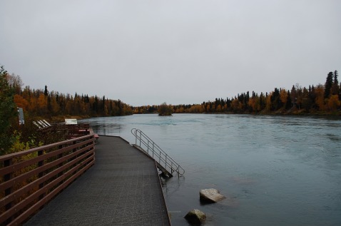
Soldotna Fishing Pier

Soldotna Fishing Pier

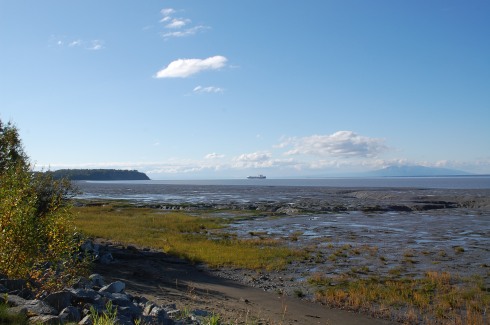
Homer, Beach

Homer, Beach

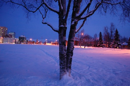
Park Strip, Anchorage

Park Strip, Anchorage

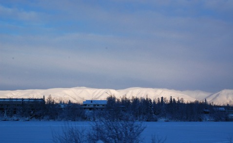
Mountains, Wasilla

Mountains, Wasilla


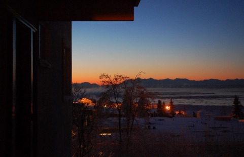
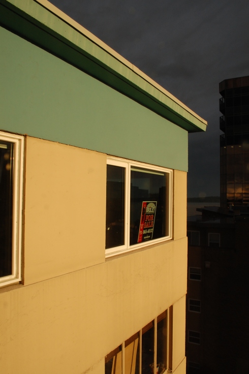
January Sunset, Downtown

January Sunset, Downtown

I’ll get back to writing soon, and finally finish up those draft posts hanging out!


The solstice has passed.  Daylight is creeping back.  The new year is almost here.

Tunnel, Coastal Trail, Anchorage

2011 has been a pretty good and eventful year, with some big highs (graduating from planning school, moving to Alaska, meeting someone awesome) and a couple lows (mainly, driving my car into a ditch and expensively ruining it).

And reflecting on that (highs and lows) got me thinking about Alaska itself, a place with some pretty serious extremes:  extreme light in the summer and darkness in the winter, extreme cold, extreme distance within its borders and from everything else, and a variety of living things (human and otherwise) that adapt to live in these extremes.  I’m already adapting some coping strategies – vitamin D supplements and a “happy” light!

Things are pretty good right now, but I feel worn out by the end of this year.  Working a lot, eating a lot, missing the sun a lot, woefully behind on things I want to do and keep up with regularly (like this blog).  So call it a resolution if you like, I’d like to focus on achieving better balance in 2012.

Bike Rack, Coastal Trail, Anchorage

Bike Rack, Coastal Trail, Anchorage

At work, this means continuing to be mindful of time management among projects, and to make some time to keep up with those things which languish without good maintenance.  It also means taking some time off work regularly, planning a few awesome vacations (whether or not I actually leave the city limits).

Along with keeping some boundaries around work and play, I would like to balance my time with more hours for photography, blogging, and general creative activity.

It also means balancing “inside” and “outside” time – taking more walks, in all weather … well, most weather.  Maybe learning a new winter activity.

And finally, better balancing my relations with others.  Making sure to spend some quality time alone, more quality time with J, to make time for new friends, and of course to make time to keep up with old friends (even if they are far away).

In general, I’d like to be more intentional about my time and how I use it, so I can stop feeling like I’m constantly fighting against the feeling that it slips away. I’d also like to have a better balance in terms of health – eat better, move better, exist better.

I won’t elaborate on the many profound thoughts one can find on the subject of balance,  but here’s a nice one:

Order is not pressure which is imposed on society from without, but an equilibrium which is set up from within. ~ Adam Cummings

Happy New Year!

Night Falls on the Park Strip, Anchorage

Night Falls on the Park Strip, Anchorage

Well, I’ve done what’s somewhat difficult to do given that I live in Anchorage … I’ve travelled even further northward!  I’m in Fairbanks for the next couple days to attend the Alaska – American Planning Association conference.

Looking forward to learning more about planning in Alaska, about why there are so many gun and ammo shops around downtown, and what this place looks like in the daylight!  It was already dark when the plane landed around 5PM, and will probably stay that way for the foreseeable future.

I decided not to bring the camera on this trip (and can hopefully head up to Fairbanks again in warmer – or colder – weather!) but will post some thoughts after I return!

Happy November, everyone.  I’m hoping it’s a happy one.

It’s actually dark at night, the leaves are browning and yellowing on the trees, and the snow marches down the mountains toward the city.  Must be autumn.

September was a silent month on the blog but a busy month in real life – and October, though busy and starting stressful, will not be similarly silent.  Which is to say, I’ll post soon.

And November is conference month!  I’ll be in Fairbanks for the APA Alaska Chapter festivities, and heading to Baltimore to throw down some wholesale produce distribution knowledge with the Society of American City and Regional Planning Historians (SACRPH).  And in the meantime, frantically tying together the loose ends in my life to make way for some new threads.

Last Warm Days on the Coastal Trail

Last Warm Days on the Coastal Trail

Autumn Along the Seward Highway


Better bottle this early morning sunlight soon...

Better bottle this early morning sunlight soon...

Modern life is keeping one foot elsewhere, a hand in the ether and an ear in the cloud.

As all things government-spending-related become topics of general debate rather than just policy wonks’ geek-out of choice, the activities of that government move into the spotlight.  And as our cities get more popular and our problems of modern living more complicated, the field of planning (land use, environment, transportation, housing, economy, other) has been lauded as the solution or attacked as part of the problem.

There’s no easy way to characterize and dissect American attitudes toward planning, and certainly no one solution to the “right” kind of planning and at what cost.  Generally speaking, though, people in my generation (finished school, starting their first job or three, married or not, moving to a new place in the city, enjoying “urban” amenities like coffee shops and parks and concert series, walking or biking to work) seem to generally view urban planning as a positive thing, where older generations tend to be more skeptical.

While recognizing this is itself a generalization, I wondered if I could explain it with another generalization:  people my age tend not to be property owners, and those older (who tend to be skeptics) are.  To them, “planning” is not about finding an affordable apartment or having a bike lane or community garden, but about how much their property taxes are, who is telling them whether they’re allowed to put an addition on their house, and whether installing a roundabout in their area will increase traffic along their street.  Not to mention homeowners’ focus on the quality of their schools, since much of the district’s expenses come directly out of their property taxes and since, if they have children, they may have made the decision to live where they do based on the schools.

No wonder they may gripe about planning!  If all they ever see of urban planning is the Board of Zoning Appeals and their water bill and annual or tri-annual tax assessment, and maybe a road improvement which increases traffic congestion or impacts their parking spot at work, no wonder they complain.  They don’t take the bus, so a new route isn’t too exciting; they spend a lot of time working on their house or in their own backyard, so they don’t go to a public park except maybe for the Fourth of July fireworks; and they’re busy living their own lives and aren’t generally called on to articulate the long-term vision for their community.  They care about paying the large bills (mortgage, utilities, taxes, school and children, car payment) they have to worry about.

This isn’t to say that people my age don’t own cars or some form of property, or inherently care more about their community (some would argue they care less, being more transient) or automatically use these public resources.  They do, however, tend to be less burdened with taxes and possessions and are in a place where they’re more open to and able to try new things; have less money, so rely on things like renting an apartment or taking public transportation or spending time in free public spaces; and may use their free time to engage in civic projects like community gardens or social activism or environmental justice work or just spending time enjoying urban amenities.  As cities, and by extension planning as a field, become the next cool thing – even Scientific American got on the bandwagon and just had an issue celebrating cities – those who haven’t yet been burdened with the full costs of modern living seem to overlook the bureaucracy and focus on the bigger, more interesting picture.

So assuming all this speculation has identified a decently solid truth, I further wonder, is this the natural progression of generational attitudes toward planning?  Or will this enthusiasm “stick” as my generation buys property, settles down, has children who need schooling, and who will eventually get stuck with the bills?  There’s already mixed evidence about whether suburban living will continue to appeal to young families, but from my very limited and anecdotal evidence, it does seem that school-age children (and/or the desire for a more traditional household living situation) will drive some people out of city neighborhoods to somewhere more suburban, less complicated bureaucratically and planning-wise.  If young people will inevitably grow out of their love of urban living and support of greater institutional involvement of the life of a city, then we should worry (again) about our cities in the next few decades, if they will again enter a low period.

If the attitude is not simply related to age and level of responsibility, however, maybe we’re really in a larger period of change.  Maybe we still need to focus on convincing the homeowners and soon-to-retire generation (who after all, still have the power as property owners) that some changes with planning are a good thing.  But maybe we also have the larger shift in attitude on our side, in the long run.

And of course there’s one huge group I have not touched on:   the elderly.  Those who may or may not still own their own homes, and who are still paying those bills (though maybe not a mortgage) like their working counterparts.  Many of those people were also young when cities were rapidly growing in the US, however, and may see a city neighborhood in a more positive, perhaps more nostalgic way.  As they age, they become more dependent on others to get around, are less able or willing to drive everywhere, and they may or may not be interested in the housework associated with “aging in place” versus settling in a denser and more active community with other seniors.  As they interact less with planning bureaucracy but face more of the issues that planning addresses, will their attitudes also change for the better?  How do their attitudes now differ from younger generations?

As with any issue or question or field of work which relies on public discourse, planning needs to care about how it is perceived by the general population.  Ultimately, planners are only there to educate and advise the public about decisions it will make about its own community and future.  The underlying perceptions of planning have an effect on each individual project or debate, and the success of our field depends in part on our awareness of and ability to positively influence those perceptions of us and our work.

Spoiler alert:  we made it!

Start:  Destruction Bay, Yukon Territory, Canada

End:  Anchorage, Alaska, USA

Miles:  542 mi

TOTAL TRIP STATS:  3,700 miles / 6 days / avg. ~ 610 miles a day, or 12 hours of driving

Highlights:  Seeing a grizzly bear and two cubs on the road right before the U.S. border … we couldn’t stop because we were in a line of construction.  Those things sure are big!  Arriving back in the U.S. after five days!  Cheap(er) gas prices, with no need for litre and dollar-amount conversion.  Seeing not one but TWO brochures for Chicken, Alaska – and stopping to take a photo of the sign at the start of the highway up to it.  Meeting a couple from Washington and seeing a moose through binoculars.  Crazy wind and mountain views all along the highway to Anchorage.  Driving through a winding mountain pass, with a road sort of tacked onto the side like it would fall off with a little shake.  Stopping to observe a glacial stream (and learning a thing or two about property ownership in Alaska… turns out even on public roads, the land itself is owned to the centerline by the parcel owners…)  Knowing this was finally, finally the last day of driving – and being able to make the push through.  Returning to multi-lane highways between Palmer and Eagle River.  Driving into civilization.  Seeing the big “Anchorage Welcomes You” sign.  Stopping.  Sleeping.  Not driving anymore.

Lowlights:  Road quality, although it actually wasn’t as bad as we had heard.  The roads outside Whitehorse were almost worse, as (unlike most other times we’d driven) it had not been previously raining, so the dust kicked up in all its dusty glory.  Getting to our motel room at 1 AM after unloading all my stuff and realizing there was no way we would get a good night’s sleep on my empty floor.

I haven’t gotten the Google map to work properly since I posted it on Day 2, but in the interim they seem to have updated the route to include that last bit of bad road between Whitehorse and Beaver Creek – before, Google directions would not even register that segment as a passable road! (And to be fair, some of it was pretty bad… full dust and gravel and major potholes).  Here is a link to the overall route map, starting from the Chicago area (and not including the drive from Ithaca to Buffalo to Hilliard to Indiana).  And here is the total route from Ithaca, about 4,500 miles.

Construction dog outside Beaver Creek - it has a jacket!!!

Construction dog outside Beaver Creek - it has a jacket!!!

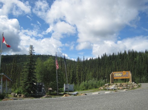
Welcome to Alaska (I should have gotten a better photo!)

Welcome to Alaska (I should have gotten a better photo!)

Finally, the Alaska portion of the Alaska Highway

Finally, the Alaska portion of the Alaska Highway

Boreal forest and mountains (Wrangell-Elias??)

Boreal forest and mountains (Wrangell-Elias??)

Chicken, Boundary, and Eagle

Chicken, Boundary, and Eagle

Mom observing the moose

Mom observing the moose

Pond along the Highway

Pond along the Highway

Serious mountain situation

Serious mountain situation

There's a glacier in there somewhere

There's a glacier in there somewhere

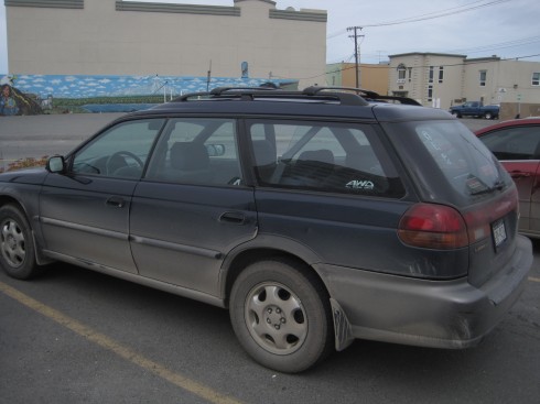
Brought some of the Alaska Highway with us.  Car needs a wash!

Brought some of the Alaska Highway with us. Car needs a wash!

Start:  Muncho Lake, British Columbia, Canada (10AM)

End:  Destruction Bay, Yukon Territory, Canada (11PM)

Miles:  602

Our best (most efficient) driving day, I think.  We didn’t do as many miles, but that was due more to the road than us.  Part of what this day feel great was that we were actually on the Alaska Highway by mid-afternoon – felt so much closer to our goal, and really started to realize how far we had already come.  The trip felt a lot more manageable being two days, not six.  And when we reached our stopping point for the night, we knew that the next night would be in my apartment in Anchorage!  (but actually ended up being a motel because it was so late and I had no furniture or anything there).

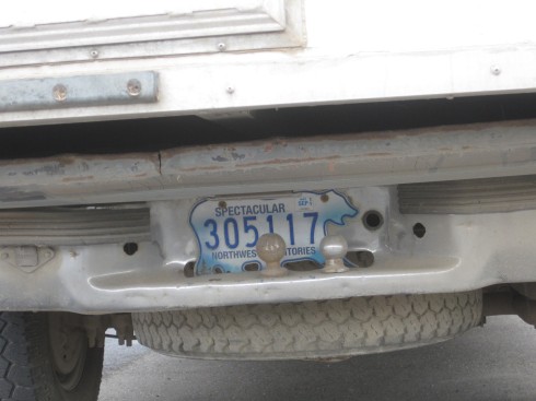
Highlights:  Seeing a herd of 80-100 wood bison on the ride of the road.  Driving into the Yukon Territory and realizing we’d pay less for gas, and as it turns out would actually have roadside bathrooms (BC doesn’t).  Watson Lake, where we were practically overrun by RVs but saw two Northwest Territory license plates, as well as the Sign Post Forest (it’s worth a look – none of the sites I found about it, including the one above, give sufficient indication of how freaking big this thing is).  Stopping in Whitehorse, the capital of the Yukon, with not one but TWO McDonalds.  Mount Logan (or was it Mount Hubbard?) in the distance.  Kluane Lake and its accompanying park – really, really amazing.  Looked like another world.  Taking a “glamor shot” of the Subaru (covered in highway dust) in front of the mountains and the lake.  The Talbot Arm Motel, where we stopped for the night, with its logo of a grizzled old gold miner or something.  Splitting a bottle of wine to celebrate (early) our trip – “house” wine, Sawmill Creek, from Ontario.

Lowlight:  As always, we put in a lot of hours that day, and didn’t get to stop as often as we might have.  Being in the car for 12 hours a day was also really beginning to wear on me, and probably Mom as well, as if my legs were just stitching themselves to the seats.  We tried to make semi-frequent stops on the side of the road to walk around, to look at the amazing scenery, and because there was really no one on the road, so it would be easy to just stop on the side of the road anyway.  More mosquitoes, though still not as bad as in Regina.

We had one more (extremely long) day of driving left, but we’re almost there!

Wood bison (including many babies!), BC

Wood bison (including many babies!), BC

Yukon Territory welcome sign, Yukon

Yukon Territory welcome sign, Yukon (also note major discrepancy in translation)


Sign Post Forest, Watson Lake, Yukon

Sign Post Forest, Watson Lake, Yukon


Walking through Sign Post Forest, Watson Lake, Yukon

Walking through Sign Post Forest, Watson Lake, Yukon


Northwest Territory plate, Watson Lake, Yukon

Northwest Territory plate, Watson Lake, Yukon


Alaska Highway, Yukon

Alaska Highway, Yukon


Mom at Mile 1000 (1610 km) of the Al-Can Highway

Mom at Mile 1000 (1610 km) of the Al-Can Highway

Coyote at rest stop, Yukon


Kluane Lake National Park, Yukon

Kluane Lake National Park, Yukon


Kluane Lake National Park, Yukon

Kluane Lake National Park, Yukon


Subaru Glamor Shot, Kluane Lake National Park, Yukon

Subaru Glamor Shot, Kluane Lake National Park, Yukon

PS – if you can to go to Kluane Lake, do it.  I would go back.

The next few posts (Days 4-6, and anything about Seward or Flattop) will be more retrospective, as they happened a couple weeks ago now.  I’m catching up to the end of the trip, then will be more “forward” thinking after that!

Start:  Whitecourt, Alberta, Canada (9AM)

End:  Muncho Lake, British Columbia, Canada (11PM)

Miles:  692

On Day 3 we stopped about 50 miles short of where we should have, in Whitecourt, a small town basically made of motels.  The Alaska Highway motel was not as desirable as I had hoped (that’s what I get for picking based on name alone) but we got on our way and saw what began to be the really awesome part of the drive.  Also of note:  it was still (twi)light around 10:30PM when we stopped at the motel, despite some clouds.  We were clearly pretty far north, and it didn’t really hit us until then.

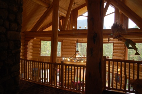
This might have been my favorite day of the drive, overall – mostly for the evening ride from Fort Nelson to our ending point, the Northern Rockies Lodge along breathtaking Muncho Lake, a long and skinny blue lake stuck among some really tall mountains.  I wish I had gotten a photo of it at night (again, not fully dark out) but the morning ones will have to do.  Also, the Northern Rockies Lodge was basically like staying in that hotel in Twin Peaks – it was a big log cabin, with each of the rooms having log walls (if on exterior walls) and a huge great room/morning dining area with windows overlooking the lake.  NRL is owned by a (Swiss?) couple, and the husband is a bushpilot (flies those small sea planes etc) who will fly guests to lodges and remote places for day tours.  If I had the time and inclination, I would most definitely go back there – driving in and out of it was great.

Highlights:  Leaving Alberta finally, although we did get to see some more lovely prairies, the start of the northern woods with its short-ish dense evergreens.  Awesome little rest stop with birches and bear-proof trash containers.  Entering British Columbia and, shortly after, passing through Dawson Creek – MILE ZERO OF THE ALASKA HIGHWAY sign.  Going past a place called Wonowon.  The Fort Nelson hotel and its Tiki lounge/ballroom area.  The drive between Fort Nelson and Muncho Lake.  Really feeling like we’re in the far north.  SEEING MOOSE!!!  AND BLACK BEARS!!!  And one sheep.  Plugging my phone charger into a log (with an electrical outlet).  Muncho Lake, which has a stupid name but is just beautiful.

Lowlights:  Not listening to the Garmin (that somehow knew about a road closure that had just happened that week) and driving west anyway, only to hit an abrupt “Road Closed” sign with a mound of dirt that redirected us onto a gravel farm road and back the way we came.  Apparently, some washouts/flooding nearby.  Hitting a miles-long backup of construction around Taylor/Fort St. John where there was single-lane traffic to get across the end of a mountain pass and major bridge – no detours here, folks.  Paying about $6/gallon ($1.40/litre) because of BC towns’ remote location and high taxes.  Also, worrying about where to get gas and where we were going to stop – luckily, a woman at the front desk of the Fort Nelson Hotel was kind enough to call ahead to what ended up being a super awesome place to stay (see above).

The next day we headed into the Yukon, officially, and ended up with a similarly spectacular (but very different looking) lakeside view on Day 5.  More to come.  For now, some photos.

Nice Rest Stop, Alberta, Canada

Nice Rest Stop, Alberta, Canada


Black Bear, Alberta, Canada

Black Bear, Alberta, Canada

Mountains, British Columbia?

Mountains, 8PM, British Columbia?

Moose in the Mist, British Columbia (wish it wasn't so blurry!)

Moose in the Mist, British Columbia, 10PM (wish it wasn't so blurry!)

Mist and Trees and Mountains, 10PM, British Columbia

Mist and Trees and Mountains, 10PM, British Columbia

Northern Rockies Lodge (seaplane dock), Muncho Lake, British Columbia

Northern Rockies Lodge (seaplane dock), Muncho Lake, British Columbia


Upstairs hall, Northern Rockies Lodge

Upstairs hall, Northern Rockies Lodge